A village walk in two parts
Part 1: Church to village centre
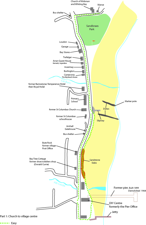
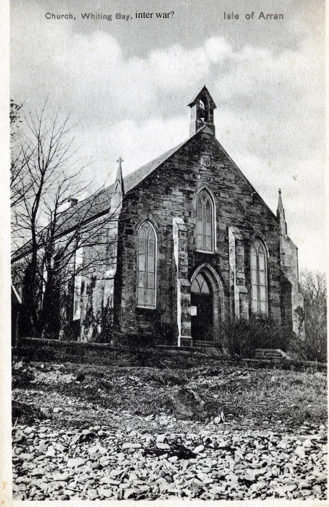
Start the walk at the sandstone Church of Kildonan & Whiting Bay next to Sandbraes Park
Outside the church, at the bottom of the bell-tower is a plaque that indicates when and why the tower was built.
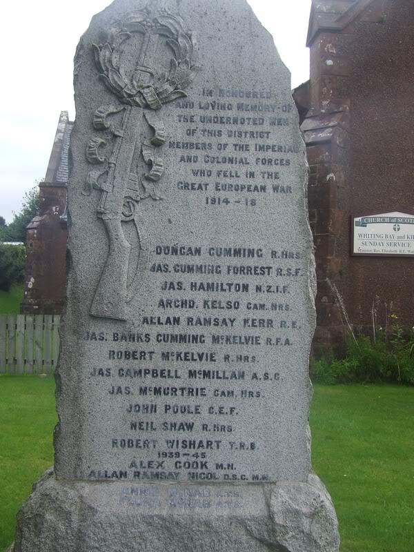
On the war memorial is the name of James Cumming Forrest. He was killed at the Battle of the Somme, 1916. His brother was in the same battle, but survived.
We also have a very interesting article on Allan Ramsay Nicol D.S.C. M.N. read here
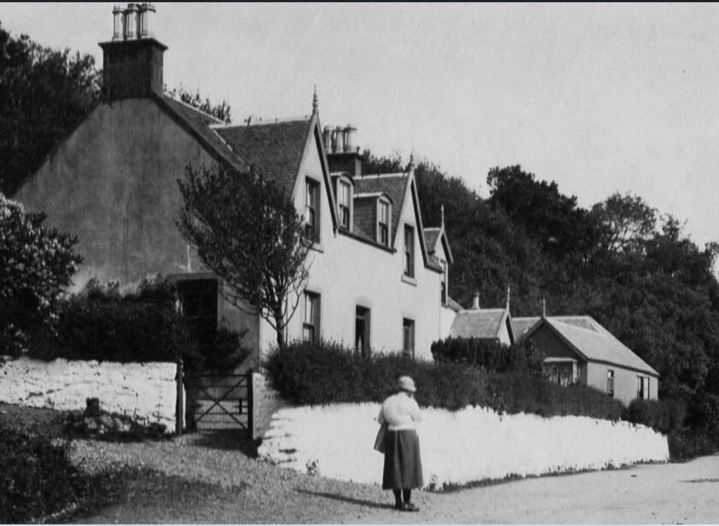
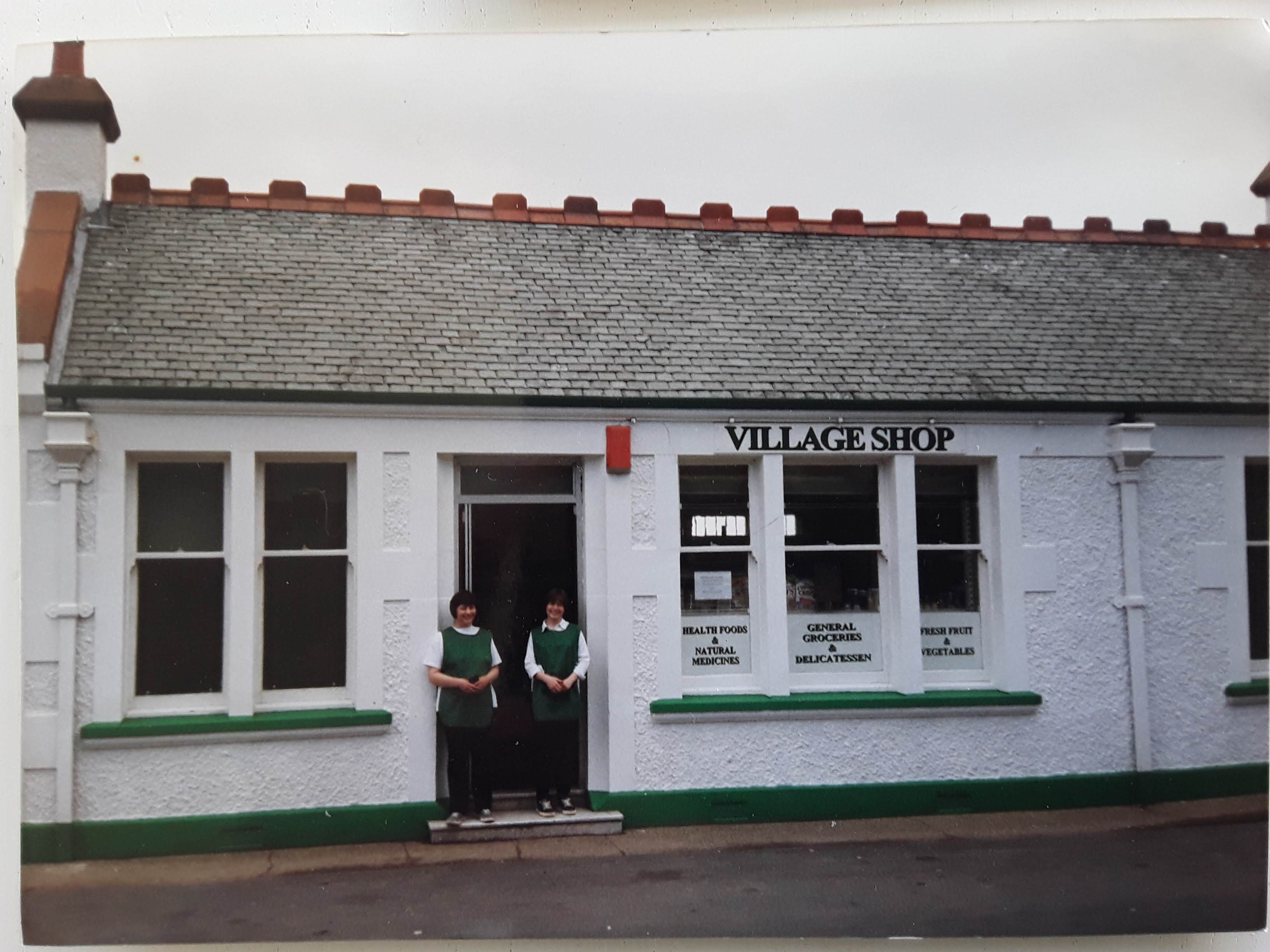
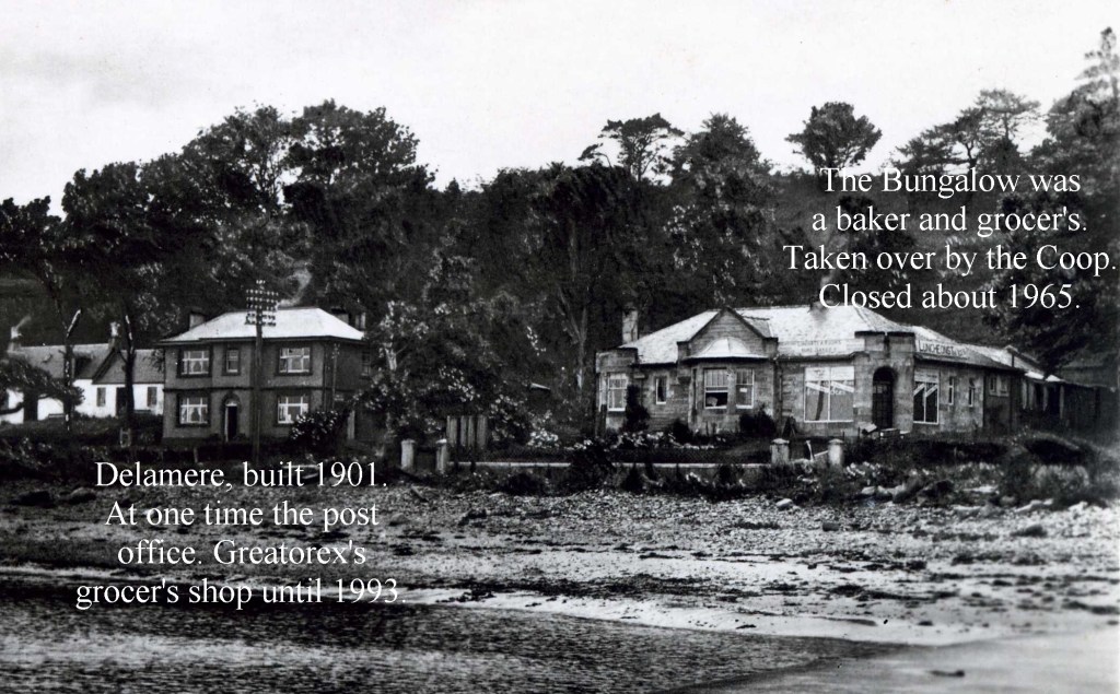
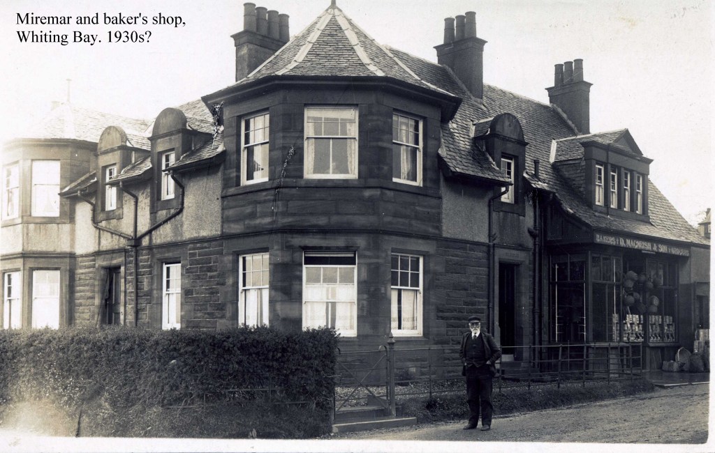
The manse is the house to the east of the church & has a particular appearance. Built about 1928, it has large windows and a hipped roof that curves a little concavely to broad eves. Bay Stores is of the same style (As are Ravenscliff and De-La-Mer in the village.)
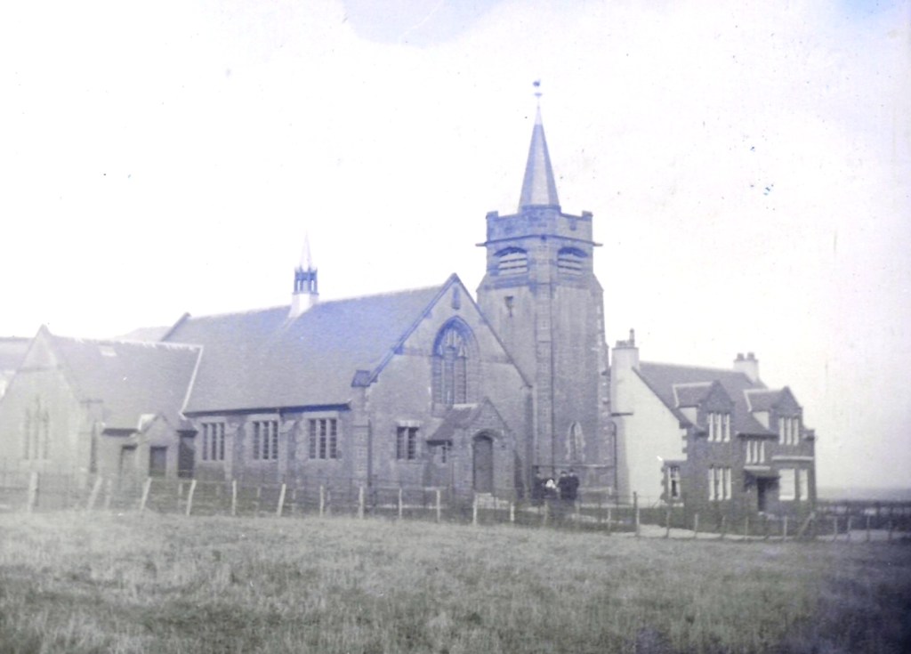
Click Here for more about the Church from Elizabeth Watson
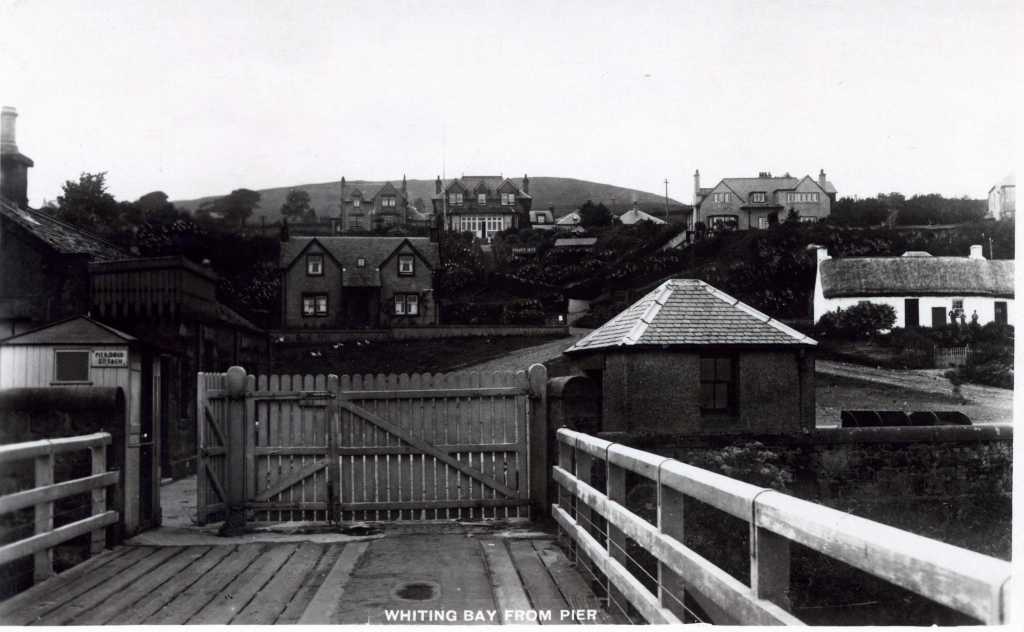
Walking up the lane to the main road is one of the village bus shelters. The art work is by David Aitcheson with some support from the community. There used to be six bus shelters built in this style, only four survive, this one, the Knockenkelly and King’s Cross road-ends ones, and the Arnhall one. They were built and paid for by, and morally belong to, the people of Whiting Bay.
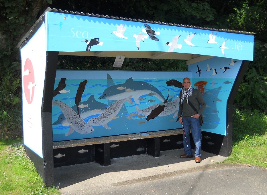
A Full History of the bus shelters can be found here CLICK HERE
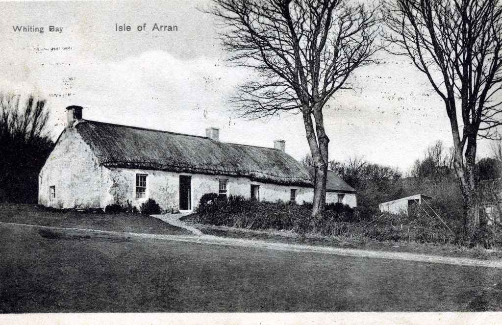
Walking towards the village on the pavement. next to the garage there is a house called Loudoun, Loudoun was built by a joiner from Ayrshire and he called the house after the place he came from. Loudoun in Whiting Bay was the first house with electricity, worked by a mini-hydro scheme from the little burn that goes under the road.
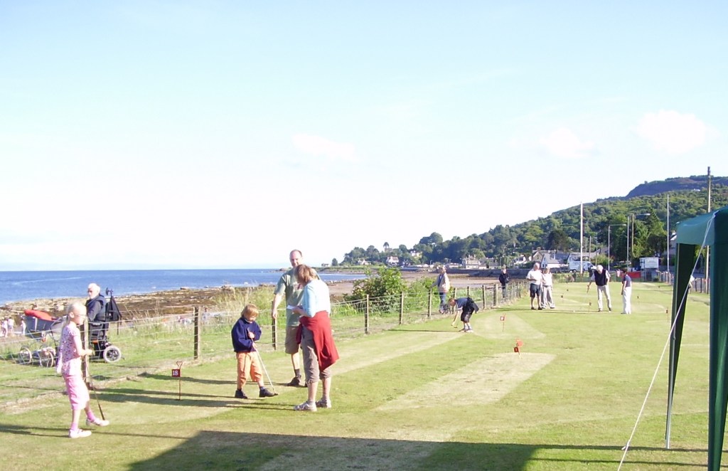
Sanbraes park is the designated landing point for the Air Ambulance service to the island, hence the windsock, on the occasions that the helicopter is called then the park is under the control of the police, coastguard and ambulance services.
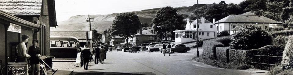
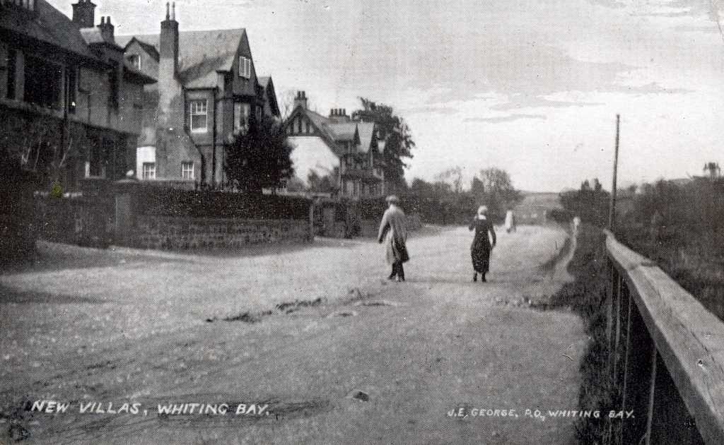
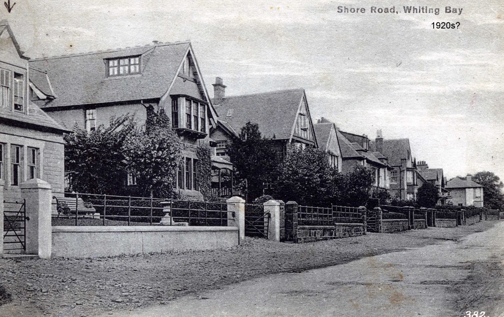
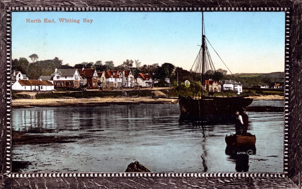
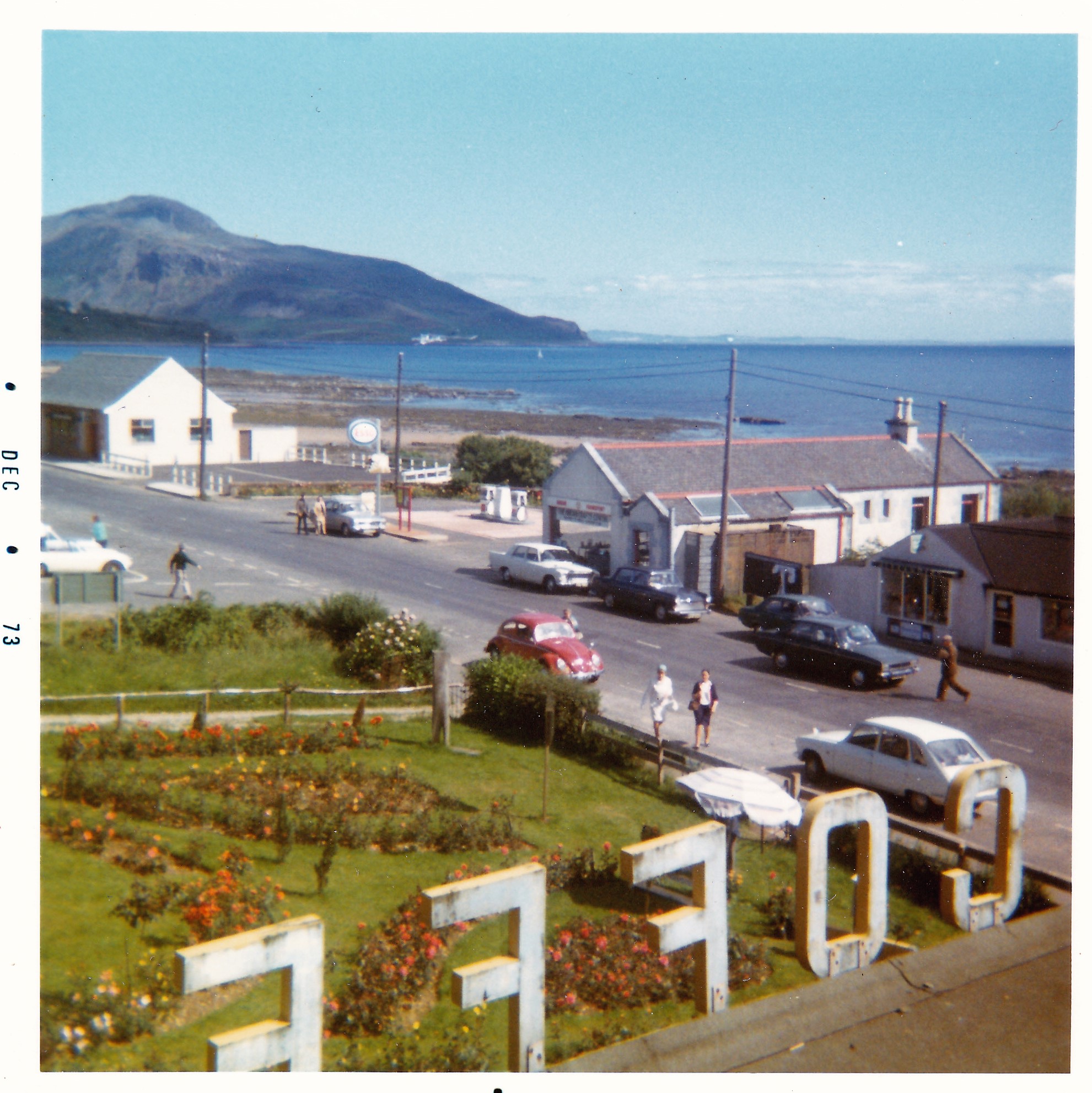
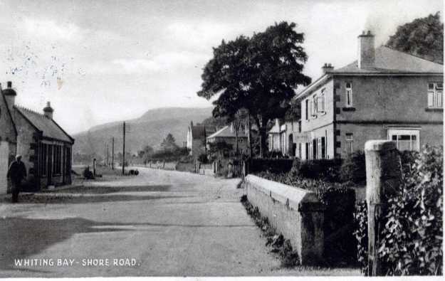
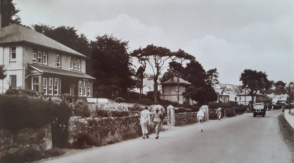
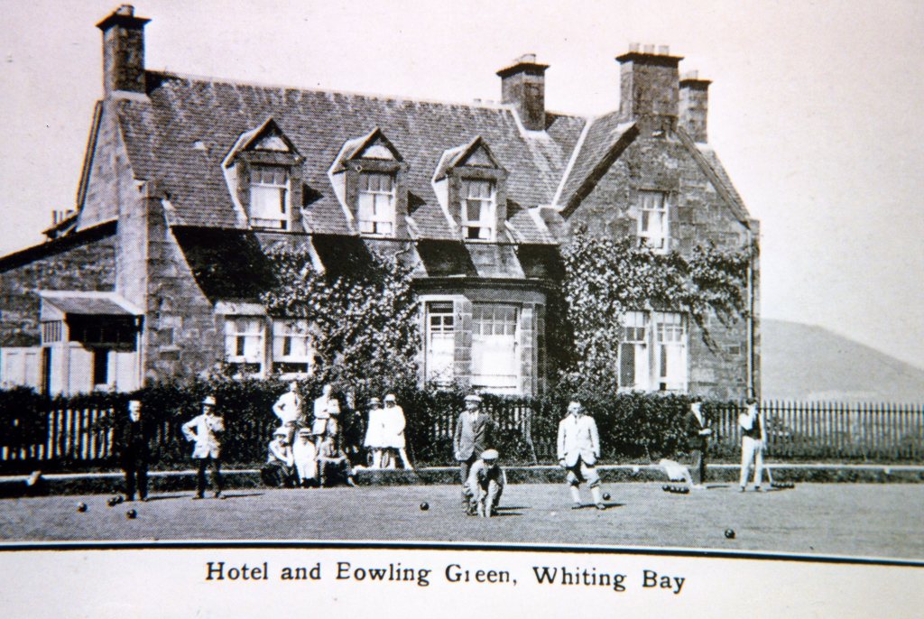
Continuing to walk along the pavement, the garage is followed by Bay Stores. Following that, the big houses called Trafalgar, Arran Brewery Guest House (which was formerly Argentine until the Falklands War when the name was changed to Traquair, later it reverted back to Argentine) Invermay, Burlington and Cameronia now the The Big Beach House. These were all built in the 1900s as boarding houses. More holiday-makers were coming to Whiting Bay with the opening of the pier in 1899.
When you come to The Big Beach House, looking back gives views across the shore all the way to King’s Cross. The gently-sloping sandy beach, this end of the Bay is sheltered from the prevailing westerly winds. Haakon came here in 1296 and Robert the Bruce in 1306. The beach made it easy to pull war-galleys clear of the water.
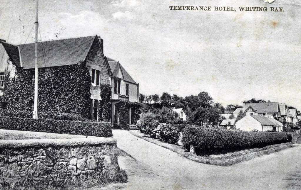
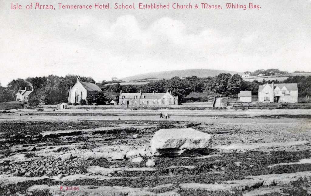
Continuing along the pavement, the big house across the lane from the school used to be called the Royal Hotel. It was built in the early 1900s as Bannatynes Temperance Hotel. That means no alcohol was served.
The man-hole cover at about the lowest part of the dip in the road is about 3.66 metres above mean sea level. In times of very heavy rain plus a high tide it is sometimes lifted out its position by the overfilled drain below.
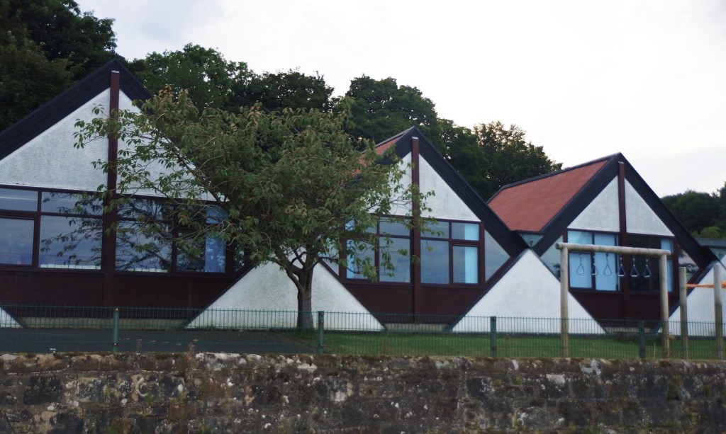
Across the lane is the school, built in 1968 and described then as unashamedly modern with its triangles and diamonds.
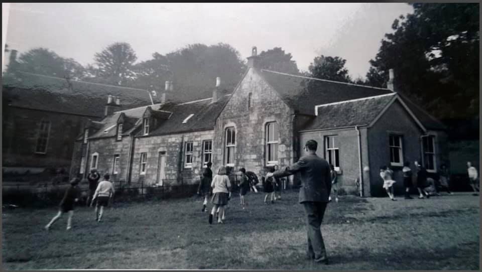
Looking carefully at the school wall on the roadside south of the letter box was the position of the entrance to the old school, patterns in the stonework and the stone step that was at the gate, are now built into the wall.
Next door to the school is the former Church of Scotland building of 1873 closed after the Second War, it was for a time an art gallery and is now a private house.
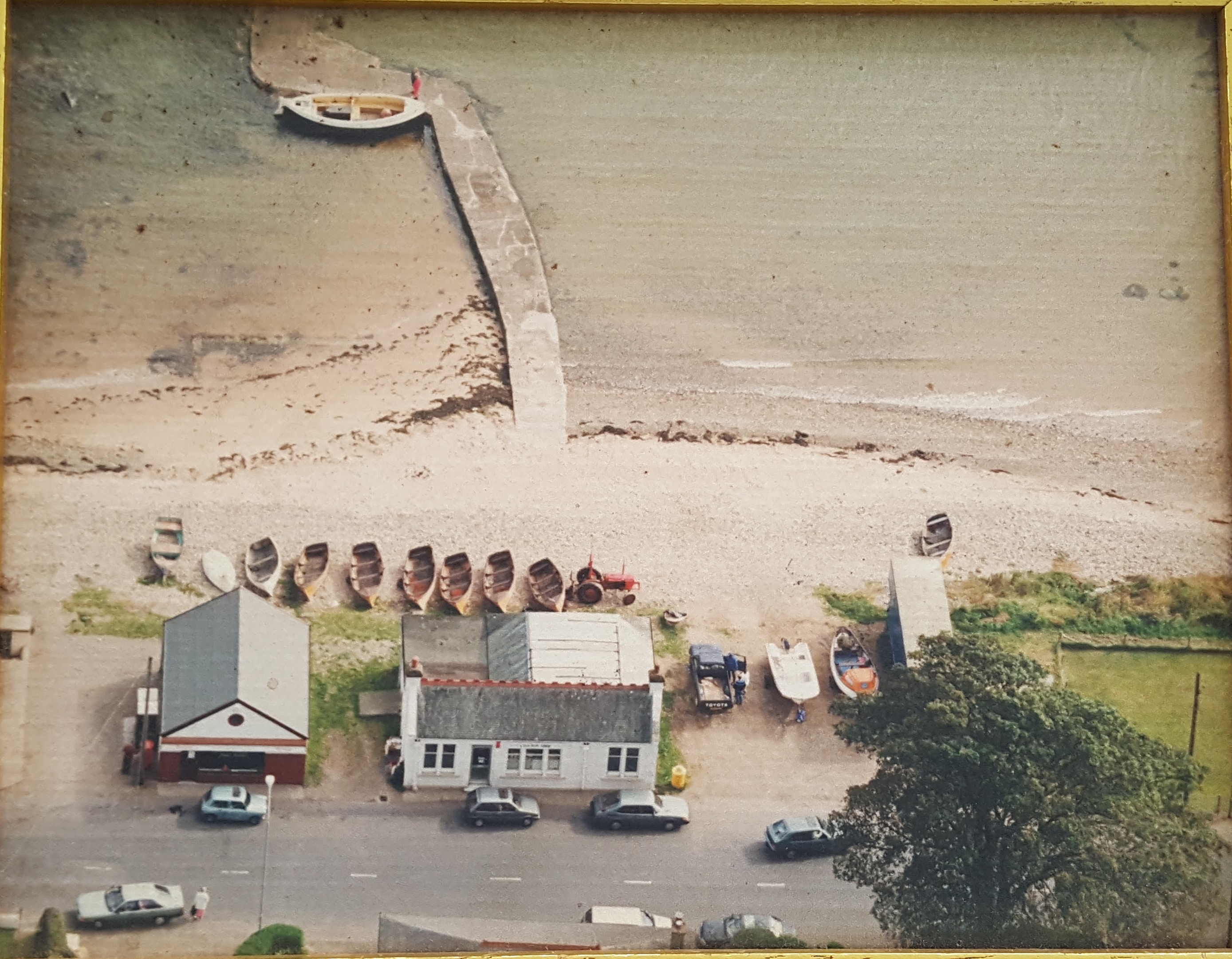
Opposite the former church is a slipway onto the beach giving boat access for launching into a little natural harbour between the outcrops of rock. Fishermen used to berth thirty metre boats here, not easy with a big sailing boat and no engine to put in reverse. At a very high winter tide, with a strong south-easterly wind, the waves splash onto the road and the harbour is swamped. So it is not an all-weather, all-season harbour.
On both sides of the harbour are wall like rock formations.This rock is called basalt and is about 70 million years old. This is quite young in geological terms. The molten rock squeezed itself up through cracks in the bedrock. Because it is harder than the rock on each side the softer rock has eroded away, leaving the wall or dyke sticking up. At the end of one of the dykes is an orange topped pole acting as a guide marker for safe passage in and out when the tide hides the dyke.
See more about the Geology of Whiting Bay Here
From here there are two choices of route:
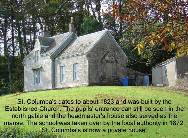
1. Continue following the road. Next door to the former church is St Columba’s of the same date as the church. It was the manse but for many years now has been a private house. On the north gable can be seen the former entrance for pupils to the church school room.
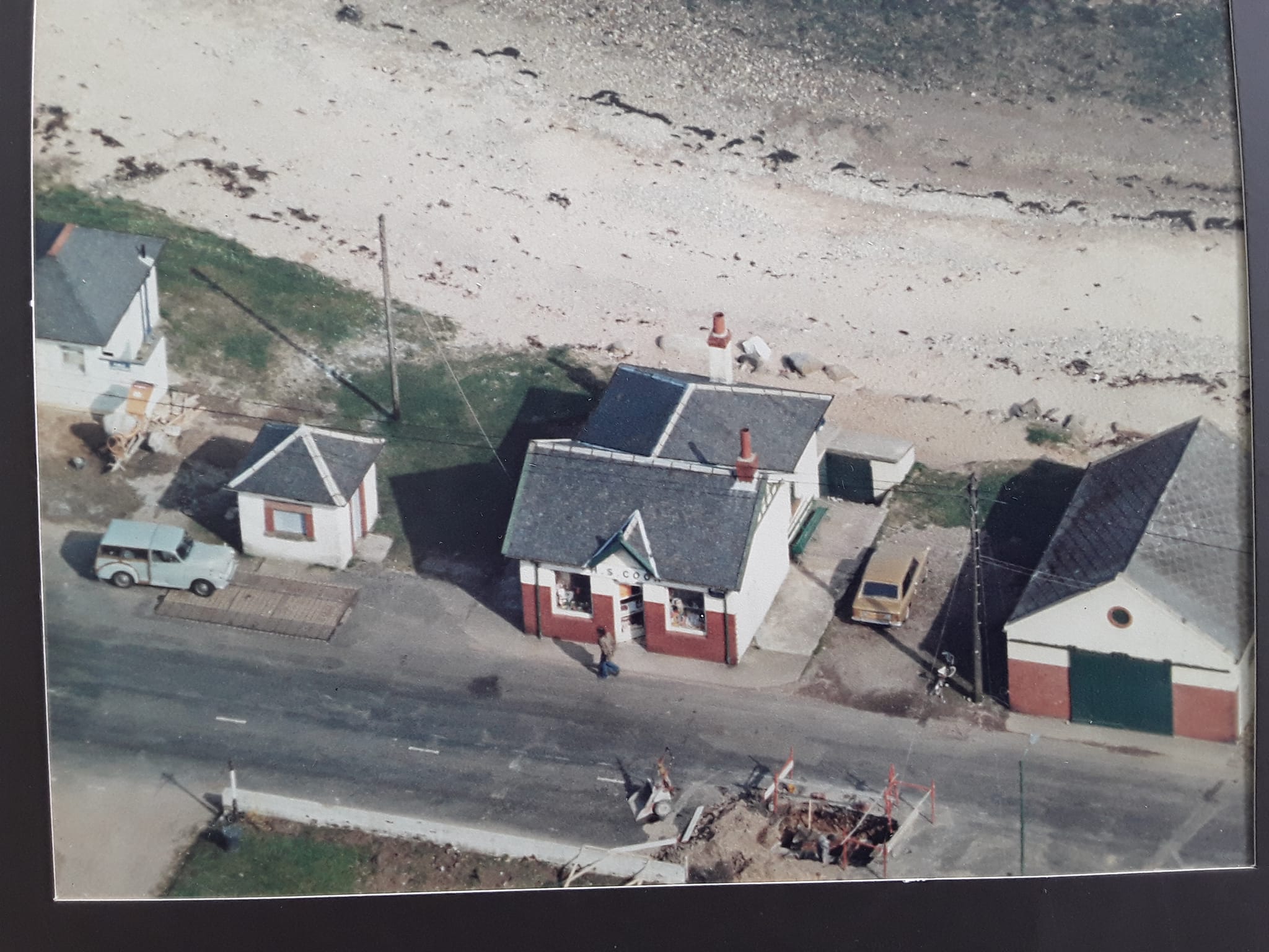
Continuing along the pavement you come to the gatehouse for Arnhall. For a time the Arnhall gatehouse was the doctor’s surgery. It is a (refurbished) private house once more. Note the triangular bay window that would give the original occupant a view out to the gate or up the track, to see if the gate needed opening. Soon after the gatehouse is another of the painted bus shelters. A little further on is Bute Rock that served as the former Post Office.
The small building in the centre of the above image is now called Bay Tree Cottage, as can be seen at one time in a much smaller building a shoe-maker cobblers shop.
Opposite here looking over the footpath railings gives a view of the sandstone blocks below (see description in route 2 below). From here it is a short walk to the village centre. (for the additional parts described in part 2 access the beach at the jetty & head towards the former location of the pier)
2. Assuming the tide level is suitable, from the slipway head south along the beach, walk along the beach to a spot in front of Bay Tree Cottage, a wonderfully designed extension on what used to be Donald Currie (Cuddy) the shoe-maker’s little shop.
At this point at the head of the beach there are large loose slabs of red sandstone. Geologists call this New Red Sandstone. It is about 270 million years old, still a bit younger than the coal that used to be dug up for your great-granny’s living room fire. Erosion of the sandstone is the reason for our sandy beaches in Whiting Bay. If you wonder where some of the big standing stones came from, then this kind of erosion along the beaches of Arran would be a source for the big blocks. At this point on the beach stretch two lines of rock sticking up above the beach. This is another dyke. Looking carefully it can be seen that the sandstone on each side of the molten lava was heated so much that it became a little tougher than the basalt istself. So some of the sandstone sticks up and the basalt in between has been worn down more quickly.
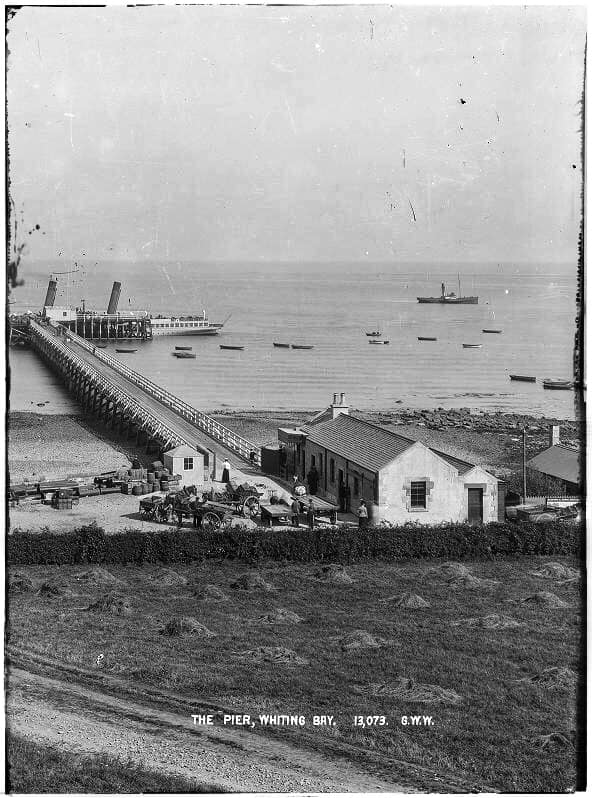
Continue walking along the beach, cross the burn and find the track of an old sewer pipe just below the DIY shop. Originally from the pier offices (now the DIY) the sewer ran alongside the southern row of piles for the pier itself. Go on down the beach towards the low tide mark to find the remains of some of the piles, sawn off at ground (beach) level. If you find enough on both sides of the original line of the pier, you can measure the width of the pier’s “roadbed.” The piles slanted from each side towards each othere so the width on the pier was a bit less than the width on the beach. click here for MORE ABOUT THE PIER
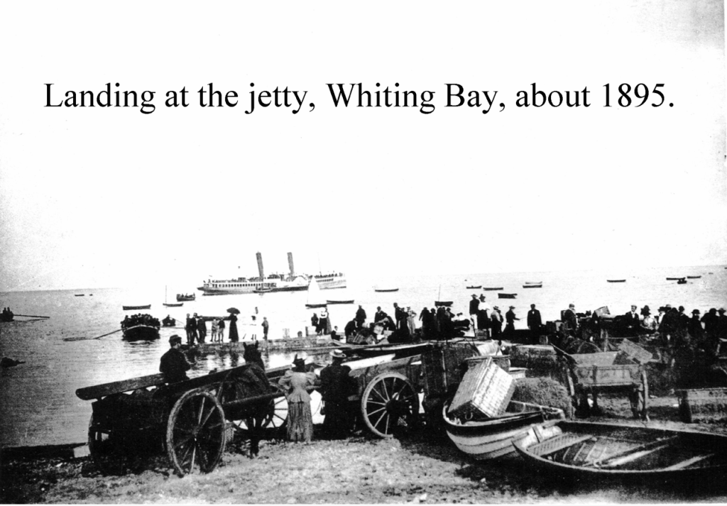
Walk further along to reach the jetty. It was here before the pier and was used to land passengers and cargo before there was a pier. The jetty had suffered erosion & damage & so in 2023 fundraising enabled the new concrete repairs to be undertaken. On the north side of the jetty just in front of The Shore café are the remains of a paddling pool. It seemed a good idea at the time, but it rapidly filled with sand & gravel due to storms & high tides. Click Here for a story
Finally, it is possible to find a ‘bench’ mark on the south gable end of the Shore cafe, near the ground, at the shop corner nearest the road. You might need to look behind the advertising boards. It is a line with an arrow under it and put there by the Ordnance Survey. (The people who make the maps.) This mark is about 4 metres above mean sea level.
End of Part One
Part 2: Village Centre to Black Rocks
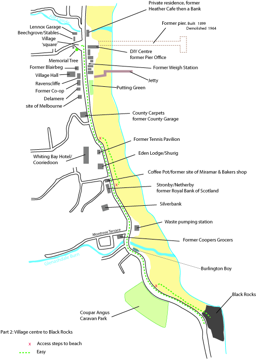
Begin in the village square, which as can be seen is actually a triangle!
In 1987 the ornamental Rowan tree on the grass to the south side of the car park was planted on the anniversary of Hiroshima. An information plaque is next to it. Peculiarly the tree has not taken quite its normal shape, but has grown into a cloud shaped bush.
The DIY buildings are the original pier offices. The little square, hipped-roof building, standing by itself was the place where heavy parcels that were to be sent by steamer and rail, were weighed for the cost of transport. MORE HERE
Between the DIY building and the former restaurant COAST is a little burn and on the north side an old concrete foundation. Here stood an unplumbed, cast iron, gents’ urinal. The urine just ran out into the burn.

Turn around and look up the hill to the top of the car park.
In 1910 before Prospect House ( which was built as the Police House) Sergeant Gunn the policeman was living here. This was also the home of the pier master.
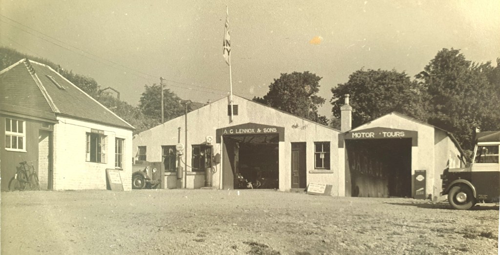
Beechgrove cottages were situated below Lennox Garages and Stables.
Following demolition in ??? A large wooden joinery workshop was built on the site during the 1980’s by David Goatley and Sons with a front Craft Shop nearest the car park. This then became a Kitchen showroom. The building has now been converted into a private house.
The Stables from Lennox Garage later was extended by Peter McCulloch and Irene Paton, it became Crafts of Arran shop with a leather and upholstery workshop. This was sold on to Mike and Betty Koral where Betty ran the shop and Mike ran Scotprint. This is now a private house.
The Garages later became Arran Transport. Then Iain Monteith purchased them and changed to Kiscadale Engineering which has now evolved into Arran Workboats.
Turn back and return to the paper shop, this was originally Kathleen Shaw’s paper shop, a much smaller building, then Joe Lenehan followed by Bernie Jackson who extended the shop after the back wall was seriously damaged during the big storm of 1991. Sue and Steve Girbow owned the shop for many years.
The shop is now Bay Wool & Crafts. Between here and the post office are the village maintained toilets and then a little brick-built shed. Inside this was a weighing mechanism and out on the road beside was a weighbridge. When lorries came off the pier filled with coal from a visiting puffer, they stopped here to be weighed. The weight of the loaded lorry minus the weight of the empty lorry gave the weight of the coal on board.
Looking across the road is Blairbeg now a private home , once a thriving Cafe.
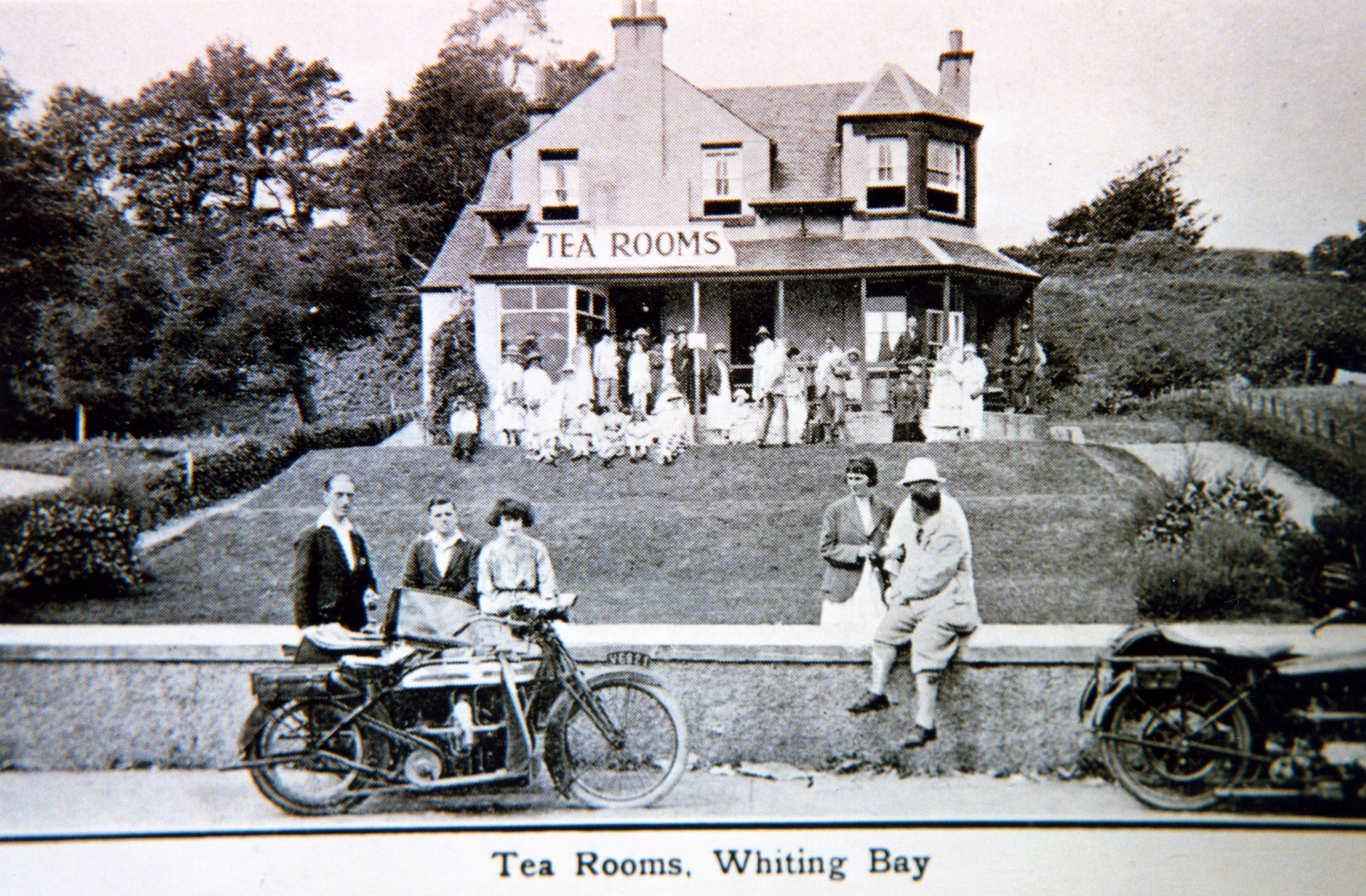
Beginning life as a Tea Room, well remembered as Blairbeg (bare leg) during it’s hay day of the 1960′ to 74. It was then Oscars, Vic’s Kitchen and then The Pantry.
Next we come to the Village Hall which opened in 1926 (history to follow)

Across the road again are:
- Post Office
- The Shore
- Putting Green
Post Office
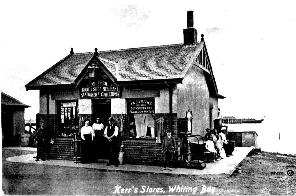
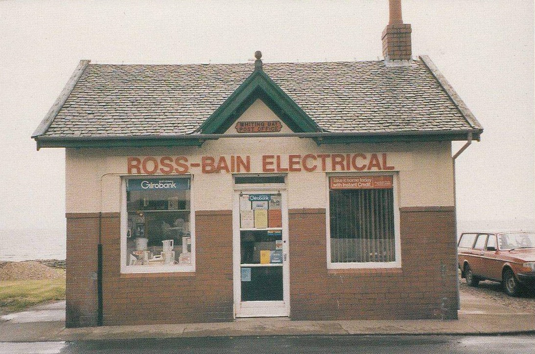
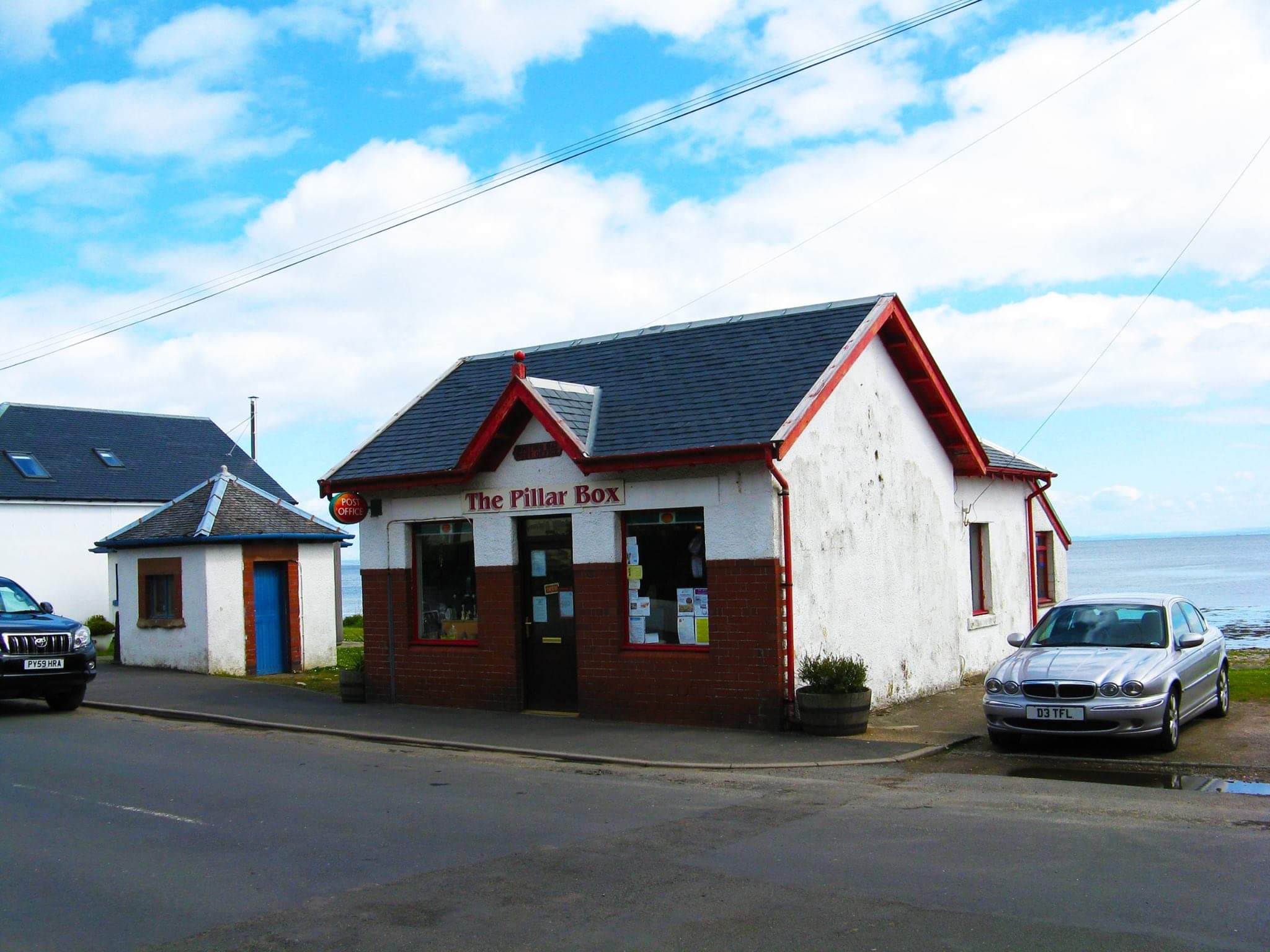
Post Office, original owner Matthew Kerr of Springhill, followed by H. S. Cook, many people remember Hamish from summer plays as well as the shop, then briefly Ross Bain Electricals including the Post Office, and an electrical showroom which was housed in the building to the right which was formerly Hamish’s store and originally Matthew Kerr’s boathouse, today this is the chemist shop. Now John Simmonds owns the Post Ofice known as The Pillar Box, the village is lucky that we have our essential Post Office and shop.
The Shore
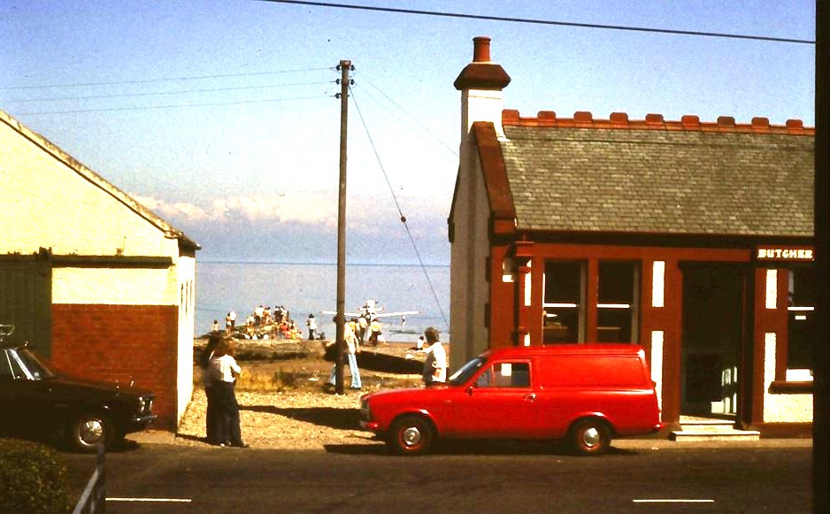
This was originally the Bank of Scotland building. The next owners were Adam Miller Butchers. Sons Hugh and Joe ran this for many years. When Hugh retired David and Reene Hadley took over. Barbara I’Anson introduced Health foods and Natural Medicines as an addition to the food shop, also removed the bomb proof bank vaults! Next briefly run by Chris and Sheila Bowen followed by Kate Armstrong, during this time extensive building work increased the size of the building, now The Shore.
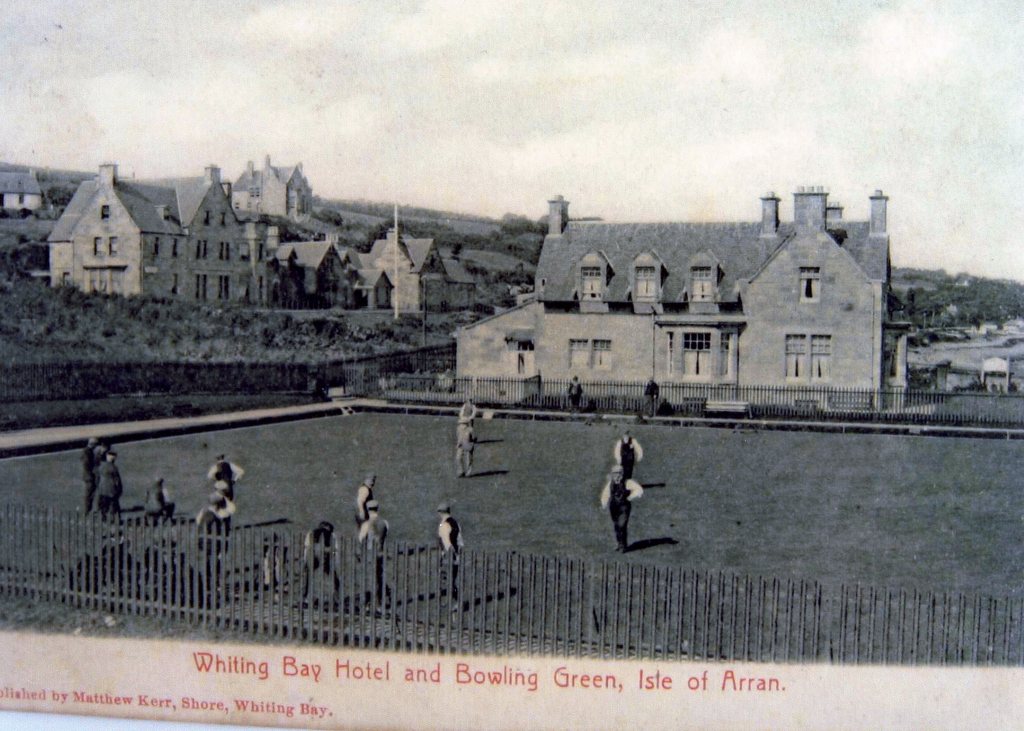
The Putting Green
Before the putting green.
A shorter Putting Green than the present one.
On the opposite side of the road.
Ravenscliffe
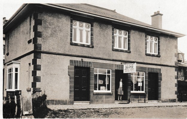
Many people still remember this as The post office.
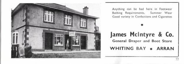
Ravenscliffe history has been shared with us by the owner Jim Morton, It was built as family business in 1923 by his Grandfather – James McIntyre. It was designed by the Architect James Houston who designed many houses in the village during the early 1920’s The upper floor was the family home.
The ground floor was for business and divided into 3 sections, it housed, A Butcher , a Hairdressers which continued until 1939 outbreak of war when no hairdressers were available and was not reinstated afterwards, a Boot and shoe merchant and drapery continued over the years with the sub postmaster agency added in 1947. Jim’s Father died in 1977 and his mother retired in 1980, the post office then moved across the road to HS Cook’s
Barry Ross-Bain (Ross-Bain Electricals) rented for 2yrs followed by Barbara I’Anson with the Arran Herb and Healthfood Shop.
In 2014 Eco Savvy took over the shop and 10 years later it continues to be an important shop for the village.
Melbourne on the left sadly burned down mid 70’s and was replaced by Craigsheen.
Follow the pavement to go along to County Carpets and the Art Gallery. The building here used to be the County Garage. It has been extended on both north and south sides. The original structure was a concrete floor with an inspection pit, standard steel frame, clad and roofed with simple brick and wood materials, or corrugated iron. The design was ubiquitous. The Belford Mill is another nearby example, built by Stewart’s Motors.
The garage became a DIY shop, with a rear section home to Mary, then Julie Nelson as hairdressers. Later the central section became a mini supermarket, which was closely followed by County Carpets, today 50 years on it is in the safe hands of Tim Wilkinson. The DIY store which was in the right hand section, was owned by Bill Jones. This then became Arran Art Galley with Nick Giles.
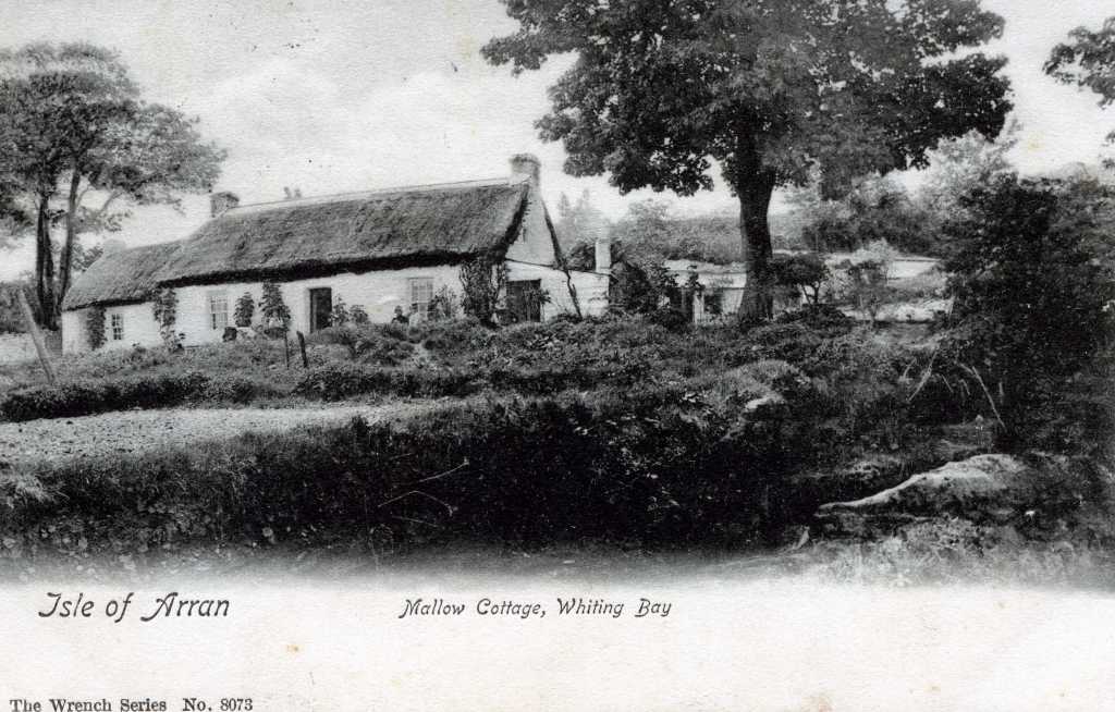
Harry Wilkinson purchased the building in 1972, also the adjacent plot which had been the site of Mallow Cottage. The replacement house built by Harry is also called Mallow Cottage.
Opposite the end of the steel fence, and the start of the sea-wall, there are three roadside houses. The first and smallest used to be the tennis pavillion. The other two are built on the old tennis-courts, in front of the former Whiting Bay Hotel
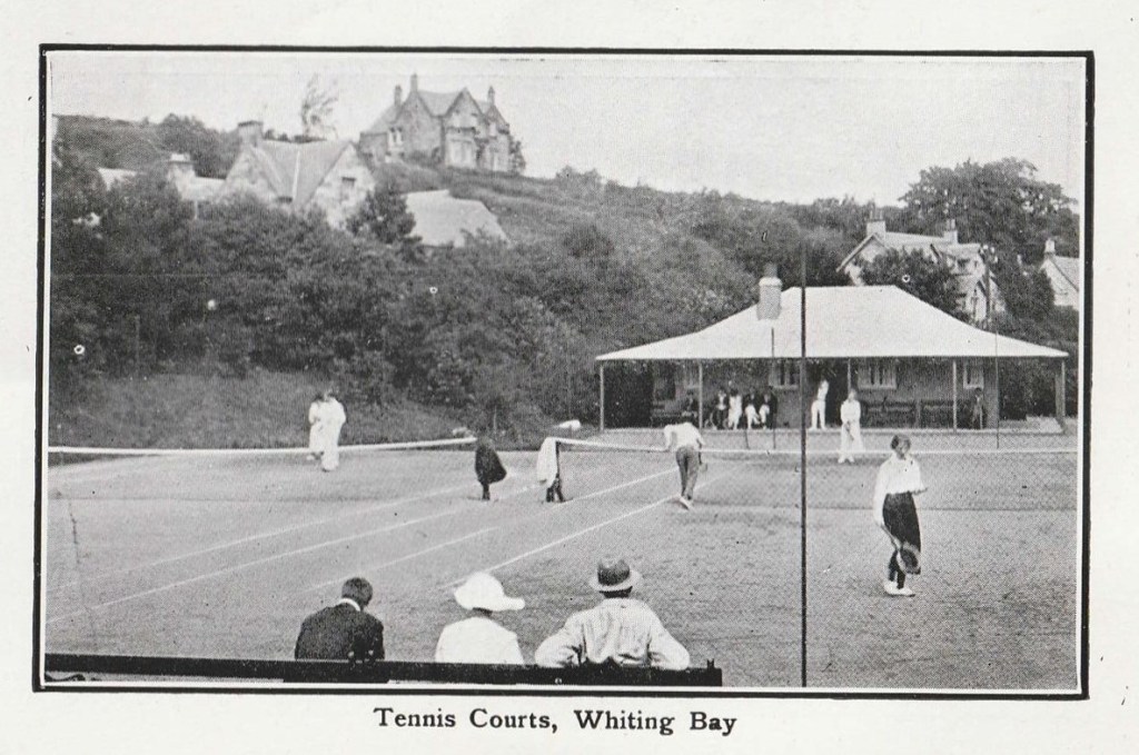
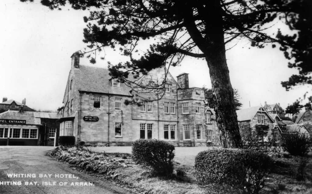
The Whiting Bay Hotel became Cooriedoon Nursing Home. Now closed.
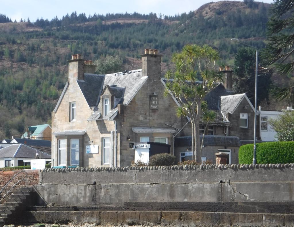
Eden Lodge, Shurig Bar
Just beyond this point it is possible to access the beach via a line of stone steps through a gap in the sea wall (be aware that these are often slippery). Walking along the beach under the sea wall there are places where storms have caused erosion and damage. At the section opposite the Coffee Pot the wear along the bottom concrete is clear since it was put in place about 1960. The original wall has occasional large blocks of stone at right angles projecting out, on the inside this feature is repeated below the road-bed. These were probably included to help tie the wall in place giving it additional strength and stability.
At this point it is possible to return to the road at the steps in front of Netherby, cross CAREFULLY to the pavement. (be aware that these steps can also be slippery at times)
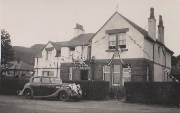
Stronbuy and Netherby were originally one property and were the Royal Bank of Scotland buildings.
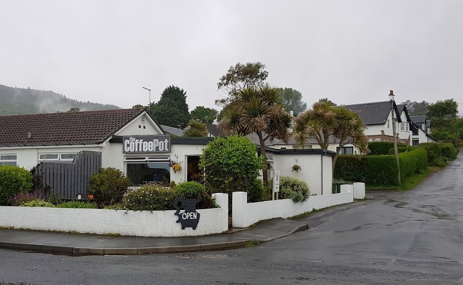
The Coffee Pot The Story of the Coffee Pot Here and neighbouring bungalow are built on the site of a baker’s shop, burned that down about 1974. The shop, bank buildings and Stanford were all here by about 1904.
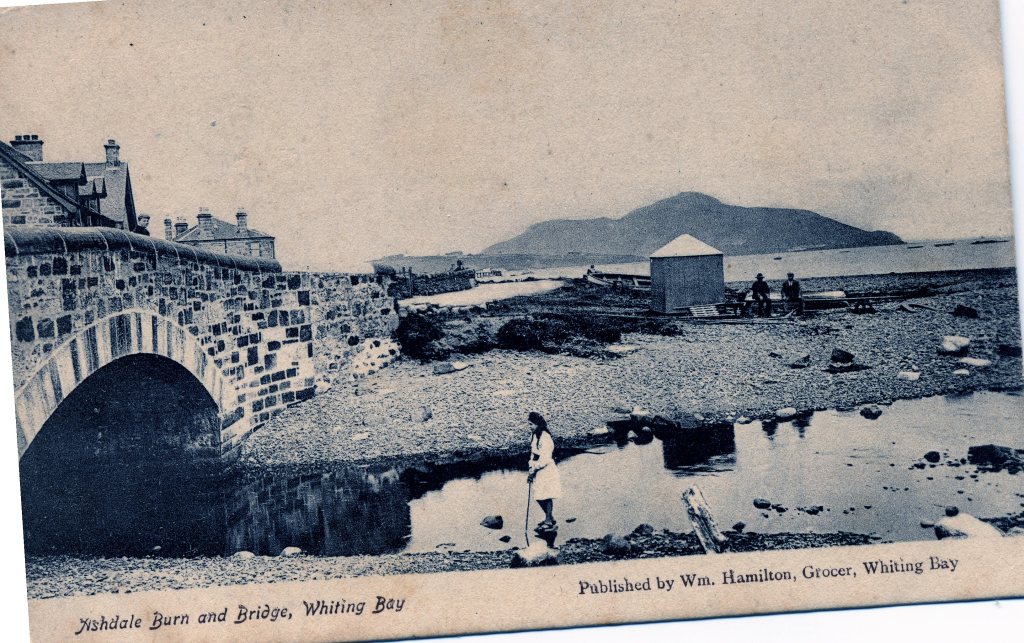
Walking along the pavement the imposing building set back is Silverbank, built in the 1770s. The ground in front of this house often floods, possibly because many years ago the Ashdale burn used to flow into the sea at this point.
Continue walking along to Montrose Terrace. The first houses here were built from 1950. Across the road opposite the end of the Terrace is the new sewerage system pumping station for the village. READ The Montrose Terrace Story HERE
The properties on the south side of Montrose Terrace were at one time all under the same owner, who was a grocer. The shop front faced north and is now a private flat. READ about William Hamilton here
Later the buildings were owned by Cooper’s a famous Scottish grocery business. There was a garage for their delivery van, built in the style of the County Carpet/Belford Mill structures. The site is now occupied by the medical centre.
After the removal of the Coopers sign the name changed to Mother Goose and a mural was painted on the side of the building. This has housed The Pancake Place and later Gus Macleod followed by Marc Head sold Barrs Lemonade and soft drinks wholesale and pet foods. Today this building is all private housing.
Crossing the road CAREFULLY, going down on to the beach, here the remains of the first public sewer are evident as a long rectangular shape in concrete. As in other places this too fed all the sewage from this side of the middle of the village directly into the sea.
Returning to the road cross the bridge over the Glenashdale Burn the original bridge was widened about 1960. Evidence of this can be found by looking under the arch on the shore side.
Note the boat hirers shown in this image.
Shortly after is a car parking area that includes the bus terminus, the bus-shelter here replaced one of the iconic shelters built by the people of Whiting Bay, this was because this whole corner has been under attack from the sea since the 1960s when Bute County Council took lorry loads of shingle from the spit that was on the south side of the burn, to use as road balast. North Ayrshire Council knocked down the iconic shelter when it built the present sea defences.
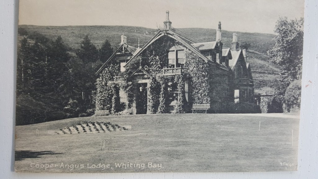
From the spot where steps lead down to the beach, across the road is the Cooper Angus Caravan park. This was the site of a big house called Cooper Angus, built in the late 1870s. It had its own fruit and vegetable garden on the south side of the house. Duff Cottage at the far end was part of the property, perhaps for the gardener.
Turning around 180° to look over the sea wall it is possible to make out a line of large, but now scattered, rocks. This was a jetty at one time, and would be for the big house. And as elsewhere it was also the line of the sewer from the mansion, again, pourring untreated sewage directly into the sea.
The sea-wall here was repaired in the 2000s. This whole curve of Cooper Angus sea-defence was first built in the 1900s and was the first sea-wall at this end of the village. At present it comprises of the original sandstone base now surmounted by the concrete upper part.
Continue on this side of the road to the Black Rocks. Normally where there is no pavement you walk on the right facing the oncoming traffic. On this next stretch the wisdom suggests walking on the left where there is a better verge to jump up on.
From the highest point of the Black Rocks. Looking to the south, just beyond the bungalow houses. It it possible to see a yellow marker buoy out on the water to warn of the outfall from the villages new sewage pumping station. The sewage is treated and the cleaner effluent goes into the sea at all states of the tide.
The Black Rocks are made of basalt; molten rock that squeezed itself between two other layers of rock, like the jam in a sandwich. This geological feature is called a sill.
If the tide is out, it is possible to return by the beach to the steps at Cooper Angus, after which it is poosible to retrace steps on the pavement all the way.
In the event of a high tide or poor conditions the 2 sections on the beach can be by-passed by following the road.
This trail began life as a walk by Jim Arnold. The memories group have included additional images and information contributed by group members. Maps Produced by Graham Wood for Whiting Bay Memories Heritage Trails.
Copyright © All information, maps and images used on this website should not be copied or used without the permission of Whiting Bay Memories. Images and information have been shared with the group and this includes all of our facebook members.
Join us on facebook here A private group, your interest must be legitimate.
