

The full walk takes in the three bridges that cross the Kingscross burn.
- Sandbraes – Union Bridge
- Auchincairn – Wishing Bridge
- Kingscross – Bochan Bridge.
- Before you begin please visit our safe walking page here
- Read the history of the complete Trail and 3 Bridges here
There are three parts to the walk:
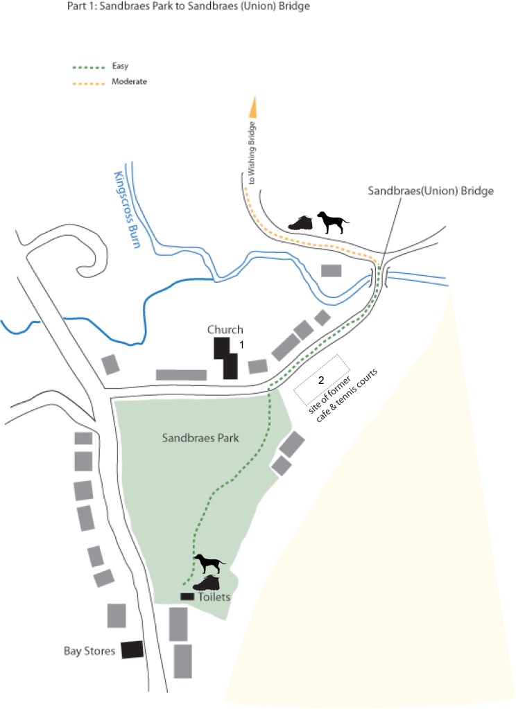
- Sandbraes Park to Sandbraes(Union) Bridge (easy)
- Sandbraes(Union) Bridge to Wishing Bridge (moderate)
- Wishing Bridge to Bochan Bridge (difficult)
Part 1 of the walk begins at a point of ‘convenience’ in Sandbraes Park next to the toilets.
Note: The park is the designated landing point for the Air Ambulance service to the island, hence the windsock, on the occasions that the helicopter is called then the park is under the control of the police, coastguard and ambulance services.
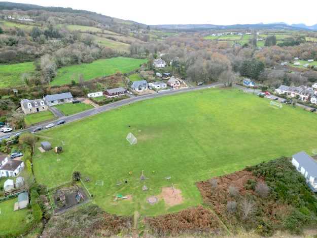
For History of the Park: Click Here.
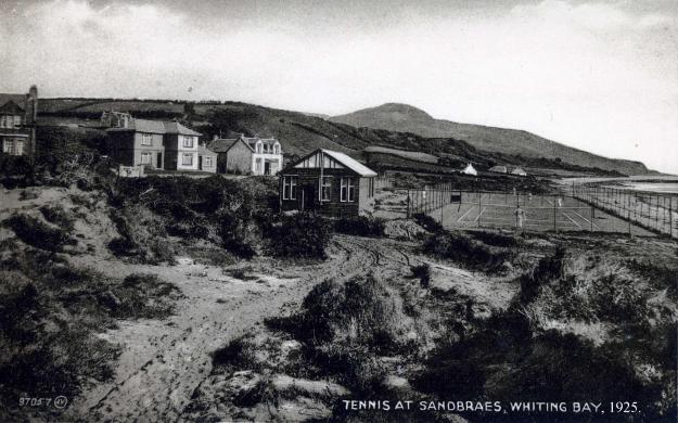
To start the walk head across the park in the direction of the sandstone Whiting Bay and Kildonan Church of Scotland. (1 on map) Leave the park at the opening on the right onto Sandbraes Road turning right to follow the road then track around towards Sandbraes(Union) bridge, this is the final crossing point before the Kingscross burn enters the sea. The site of the former Sandbraes cafe and tennis courts (now horse paddocks and stables) is on the right), 2 on map
Union Bridge
Union Bridge: a horse bridge which was erected at the mouth of the burn separating Whiting Bay and King’s Cross in October 1909.
For History of the Union Bridge: Click Here
Part 2 Sandbraes (Union) bridge to Wishing Bridge
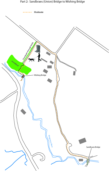
Immediately after crossing the bridge take the left turn to follow the road up the hill, this is known as Plane Tree or Shaw’s Road, named after the Shaw family. When the tarmac surface ends proceed on to the footpath/track ahead, despite once being used by vehicles it is now only suitable for walkers/cyclists. The path follows a steady uphill incline eventually opening out onto a wider access track for the houses on the left, continue until this track meets a corner on Kingscross Road
Turning left continue on the tarmac surface passing the house on the left. Following this side of the road look out for a point where a footpath leaves the road to follow the edge of a field boundary, fields owned by the Mackenzie family. (Warning: this section of the path can become wet and muddy, strong boots or wellingtons are advised). Keeping the boundary trees on your right continue across the two fields. Be aware that livestock may occupy the field and appropriate caution taken, dogs must be on a lead.
As the edge of the field begins to slope down, look out for the metal gate ahead. please close the gate after passing through. The trail now follows a path down through native woodland eventually emerging out onto Wishing Bridge.
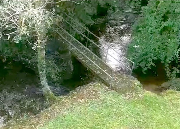

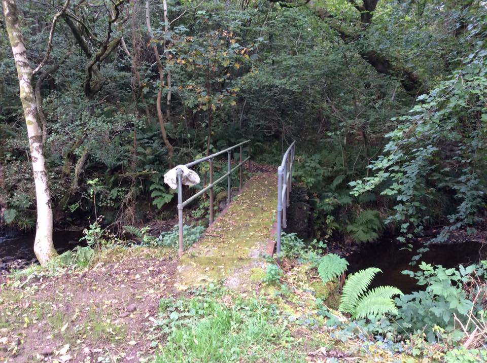
For History of the Wishing Bridge: Click Here
Cross the bridge onto a small area of open field, turning to the left follow the trail as it opens out onto a small tarmac/parking area next to the main A841 road between Whiting Bay & Lamlash.
Part 3: Wishing Bridge to Bochan Bridge
In Scots Gaelic ‘Bochan‘ is associated with goblins, ghosts, spectres & sprites. Perhaps keep your eyes peeled for sightings.
Click Here for a Bochan Bridge Tale. THE FAIRIES: THE STORY From The East of Arran by A. Boyd Scott.
Part 3
Caution: at the moment this final part of the walk involves walking on the grass verge of the main Whiting Bay to Lamlash road, please take care when crossing the road & following it up to the site of Bochan Bridge. (not suitable for unaccompanied children)
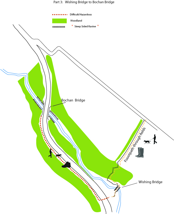
For the History of the Bochan Bridge: Click Here
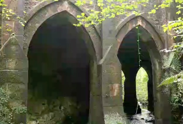
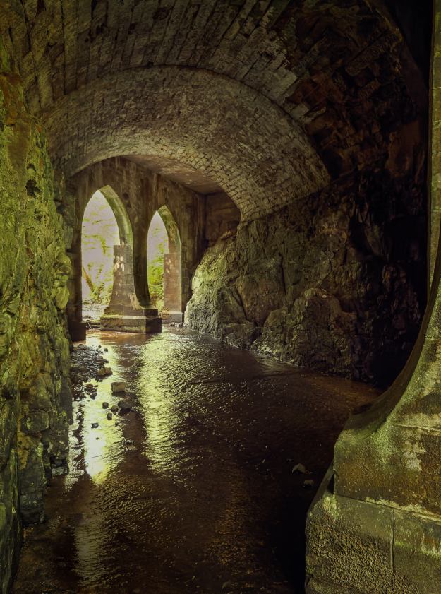
From the roadside the bridge is seen as two sandstone parapets, however at this point the Kingscross Burn passes through a deep steep sided ravine, consequently beneath each parapet is a substantial and ornate structure. An idea of it’s scale can be seen by very carefully looking over either parapet. At the moment the is no safe way of getting a better view, due to a mixture of dense tree cover and the dangers of the sheer sides of the ravine. There are though several photographs showing how impressive the structure is. From this point returning to Sandbraes Park can be a case of either retracing the walk in reverse order or taking the more direct route of following the main road back to the village. Again, please take care, as until the road reaches Fen Place there are no footpaths, therefore the grass verge has to be used.
Maps and Trail by Graham Wood for Whiting Bay Memories Heritage Tails and Trails Project.
Report by Simon Ross-Gill
Here is my report on the Bochan Bridge: It takes about 20 minutes to walk up the burn from the wishing bridge, on the kings cross side of the burn, and though there is evidence of old paths and some clearings, it is thick with bracken and brambles in places and criss-crossed with barbed wire fences. The route leads higher above the burn as you get to the bridge, and you end up at the level of the road. Waders would definitely be necessary to approach the bridge from underneath, and gorge walking is a possibility, probably easier from the other side (starting up towards Auchencairn). It is fairly easy to find a view of the bridge from above by walking a few footsteps from the roadside, though care must be taken with the steep sides. There is some beautiful woodland around that place and old birch forest.
Difficulty: Very hard
Time: less than half an hour from Wishing Bridge / less than 1 hour round trip
Note. We would be very pleased to receive comments, reports, suggestion and questions. Just Contact Us
