
Trail to Largiebeg Point

Length: 1.5 – 2 hours, from footpath sign next to Seaview at Largiebeg Point. This takes into account the need to walk carefully along the shore stretch (a third of a mile approx.) If walking from the village centre of Whiting Bay allow an extra 40 minutes each way.

Type: moderate to fairly challenging – most of the walk is flat but care is required on large pebbles/small boulders along the shore. There is a short downhill section at the beginning and one uphill section on the main road if starting in the village.

Good footwear is recommended due to the uneven walking surface along the shore. One or two stiles (good condition) need to be climbed.

Access
The trail can be accessed on foot from the village centre (40 minutes). Head South along the main road towards Kildonan and follow it uphill, past six or so houses at Largiemeanoch and then ten minutes up the hill until just beyond the turning down to Seaview on the left.

The 323 bus (South Island) will stop at Largiebeg, just beyond Seaview, if requested.

If travelling by car you can park either at the small lay-by at the footpath sign, or at the large lay-by at the Gerry slip which is one minute’s drive beyond Seaview and the two houses on the right just up the hill beyond it (one is named Ayr View). The lay-by is on the left where the road flattens out. From there it’s a five minute walk back towards the village to the trail starting point.
Please Note A PDF is available download at the end of this trail
PLEASE READ our safe walking guide
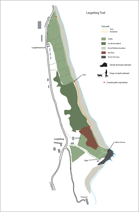
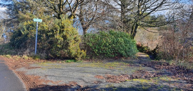
1. The starting point is the signposted Arran Access Trust footpath just before, or after, Seaview (depending on whether you arrive from the North or South). This heads downhill and can be a bit muddy and slippery in places.
The second half is drier as it has been scattered with ash from Archie Nicol’s fireplace. As the view opens up you will see Seaview and some outbuildings to your left.
Read our Seaview history and the Largiebeg smugglers’ tale here
2. Head right and walk to the bottom of the grassy, wide track. Again, this is can be a bit slippery in places after heavy rain.
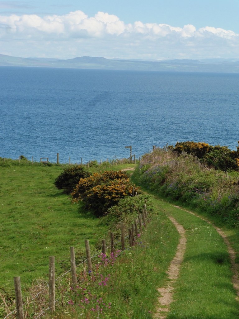
The track ends with a stile to the left and excellent views to Ailsa Craig to the South.
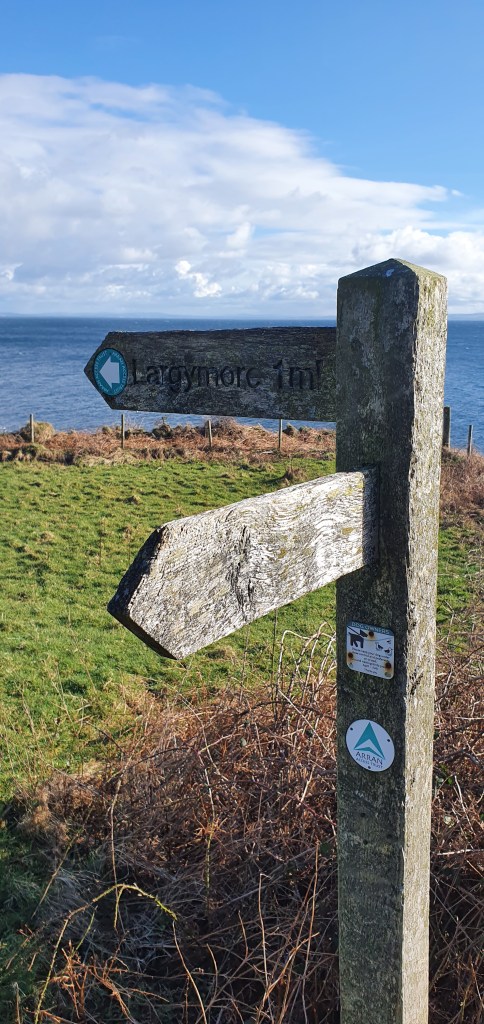
3. Climb over the stile to the left, signposted Arran Coastal Path and Largymore and skirt around the field towards the headland, visible below you to the right.
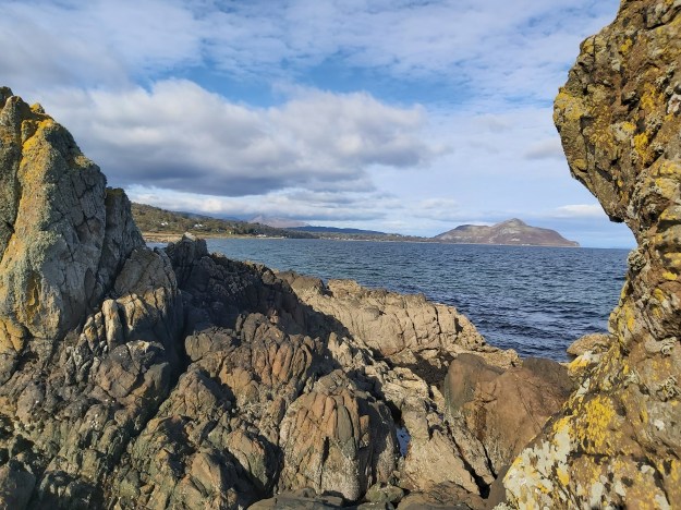
A few yards beyond the stile and looking East you will see another small stile which, if you climb it, leads you to a steep, stepped, narrow path through a crevice in the rock to a pebbly shore and the barely visible remains of a large natural arch. If you tackle this small detour, you will probably need to retrace your steps back up to the field as the area between here and the headland is rocky and may not be accessible, depending on the tide. Great care is needed on this steep path.
Note the large house on the shore (Trareoch) and a small house directly in front of you, nestled on the beach below (Shore Cottage). You will see the gate to the path down to it just in front of you.
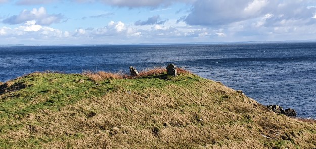
4. Once back on the path in the field skirt around a small mound of grass-covered stones (possibly once a small cottage or settlement) and follow the stony path down onto Largiebeg Point. Here you will see two small standing stones which, if you align them correctly, form a straight line between Holy Isle to the North and Ailsa Craig to the South. There is a suggestion that these were deliberately placed to form a type of ley line; alternatively they are said to be the remains of the graves of two sailors, although they are mighty hefty stones to be dragged up there for that purpose.
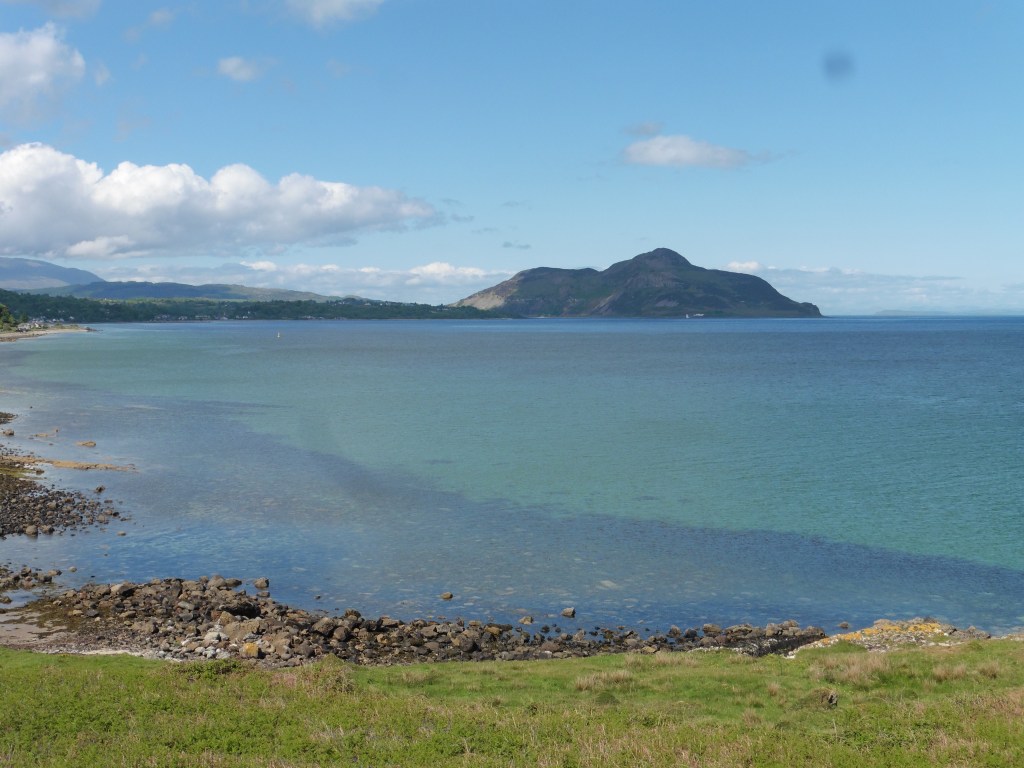
5. The headland offers panoramic views to Holy Isle and Ailsa Craig, and you can also take in the view of a long stretch of the Ayrshire Coastline from Hunterston and Little Cumbrae to the North to Turnberry and beyond looking South.
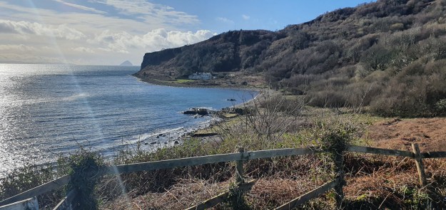
6. Leave the headland and follow the grassy path downhill, heading North back towards Whiting Bay village, visible in the distance. To start with this path, which is part of the Arran Coastal Way, stays within the field and follows the line of a short stretch of low raised cliffs on the inland side. The path is fairly clear although uneven in places and you may need to fight with bramble branches in Summer. After thirty yards or so you can step down onto the shore. It is possible to get onto the shore before the field path but this little cove is a haven for seabirds, swans and ground-nesting birds such as oyster-catchers so may be best avoided at breeding times. > Look Out For The Birds
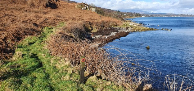
7. The shore heading North can be walked with care; you will need to pick your way across rocks and large pebbles and two or three shallow streams. In summer the groves of small trees and shrubs to your left are full of jolly yellow Flag Irises. This stretch takes about 20-30 minutes to walk, at the end of which the houses at Largiemeanoch, and further down the hill at Braehead, will be clearly in view.
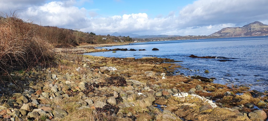
8. You will come to a fence and five-bar gate and you can open the gate to enter the first of three fields which run one after another alongside the shore. These usually have 5-8 Highland Cows living in them – if you are wary of large beasts you can drop down onto the shore to avoid them.
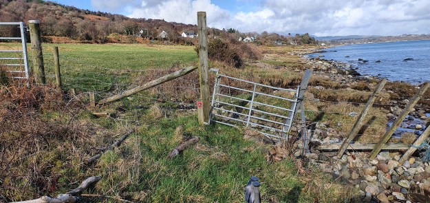
9. Climb the stile into the final tiangular shaped field and either follow this to the end or exit through one of two gaps in the hedge onto the main road into the village. As the road flattens out you will pass the sign to Ardmhor and you will then be at Largiemhor, just before the start of the village and at the end of the walk. From there it’s a 20-minute walk to the centre of Whiting Bay village. The 323 bus passes here or you can walk to the Ashdale Bridge for a more frequent service. If you are walking back up to the Gerry Slip lay-by to retrieve your car it should take around 15 minutes.
N.B.
- Largiebeg – The little hillside
- Largiemeanoch – The medium hill
- Trareoch – Pebbles on the beach
Whiting Bay Memories offer you 4 pages and many hours of a written and pictorial history to support this trail.
- Ships and Smugglers Tale a long read with lots of old pictures.
- The Secrets of Croftmore a film starring David Tennant filmed at Largiebeg.
- Largiebeg & Largiemeanoch History
- Largiemeanoch Memories Memoris of Norman M Bowman (1912-2012).
Trail by Cheryl Burgess and Map by Graham Wood for Whiting Bay Memories Heritage Tales and Trails project 2023/4
